Relignaree has been described as large univallate circular enclosure with an internal diameter of 100m from bank to bank. The majority of the enclosure is not presently served by an external ditch except for a section which does remain insitu north-west of the monument, measuring 6m wide and 50cm deep. It is accepted that the later use of the land for farming has eroded such features. There are a number of breaks distributed throughout the enclosure banks which may possibly be the result of cattle grazing.
 |
| 3D LiDAR model of Relignaree (Image courtesy of OSi & Kevin Barton) |
Placename evidence is a value source to be able to inspect when conducting archaeological research, however, it not always a completely reliable source from which to gain information about a monument or area. Unfortunately, Relignaree is an example of this. Reilig na Rí, the graveyard or burial-place of kings, was another of the placenames thought to be have been recorded in the 18th-century which appears to provide a role for the monument that is very different from the evidence. It is interesting to reiterate the description of Cruachan as being one of the three Heathen cemeteries of Ireland and an important place of burial and funerary practices in the Iron Age period. Through reinterpretation, the erroneous placename evidence of Relignaree in a wider context may potentially find its origins in a local folkloric remembrance of some human interactions with the wider complex in times gone by.
 |
| The above magnetic gradiometry image highlights the now invisible complexity of Relignaree, with a number of concentric rings indicating the possibility of a long and protracted interaction with the monument (Image courtesy of Brian Shanahan & The Discovery Programme) |
A later field system runs across the entire site, physically dividing the enclosure into four unequal quarters. This feature has been theorised to represent the four provinces of the island but this is a more sensational claim given the timeline and known use of the site. Within the enclosure there are traces of a smaller concentric enclosure, with a bank that reaches between 50 and 100cm in places. It is also possible to trace three rectangular houses and a souterrain on the site, further evidence of the monument's use for settlement.
 |
| Aerial photograph of Relignaree, showing the later field boundaries, concentric circular enclosure, and habitation evidence |
 |
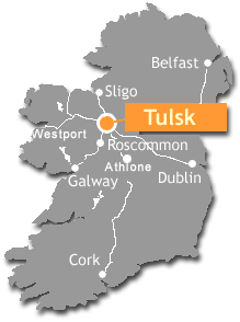
Relignaree can be seen in the south of this map, relatively centrally.
|
- Waddell, J., "Rathcroghan - A Royal Site in Connacht", in The Journal of Irish Archaeology 1, 1983
- Herity, M., Rathcroghan and Carnfree: Celtic Royal Sites in Roscommon, (Na Clocha Breaca, Dublin: 1988)

No comments:
Post a Comment